NepalMap makes data on Nepal more accessible and understandable.
NepalMap is of great use to journalists, students, academics and others who are interested in using data to learn about Nepal.
This tool is a friendly and reliable resource for journalists who want to use data to tell stories or discover stories that are of public interest.
NepalMap uses the National Data Profile, created by the Central Bureau of Statistics, and other official sources, to create user-friendly data visualizations on key demographic issues.
You can embed, access or download the data too. You can also compare any two areas side-by-side.
If you would like to access pre-federal data from 2011 Population Census, please check out: 2011.nepalmap.org.
NepalMap is a project of Code for Nepal, a non-profit that works to increase digital literacy and the use of open data in Nepal. Please make a tax deductible donation to help us maintain the server space for NepalMap, and empower Nepal digitally!
Shoulders of Giants
Yes! NepalMap is based on Wazimap which is
a fork of Census Reporter. Wazimap is built and maintained by Code for South Africa. Other implementations include Wazimap Kenya and Wazimap South Africa, the first Wazimap implementation. All of these tools are completely open source. You can build one for your country. NepalMap code is licensed under the MIT License.
NepalMap branding is copyright of Code for Nepal and cannot be used without permission.
Help us
NepalMap is entirely built by volunteers who are committed to ensuring everyone has access to open data about Nepal. We need more help.
We are looking for volunteers who can help us add more data, and improve NepalMap. If you have the right skills, and would like to help, please complete this form!
Privacy Policy
This website uses Google Analytics to help analyse how visitors use this site. Google Analytics uses “cookies”, which are small text files placed on your computer, to collect standard internet log information and visitor behaviour information in an anonymous form.
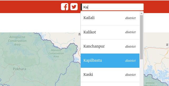 Type in the name of the district. Then select the location you are interested in from the dropdown.
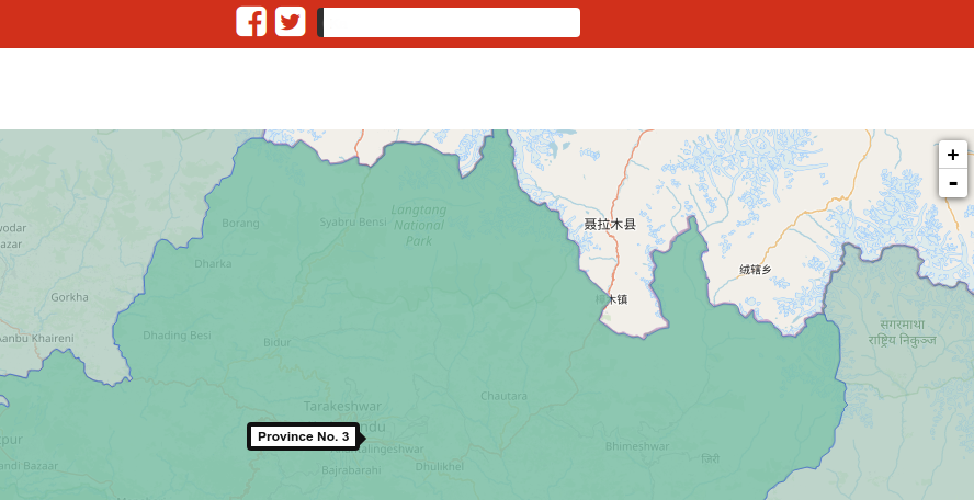 Alternatively, click on the map area you want to go to. The + and - buttons zoom in an out.
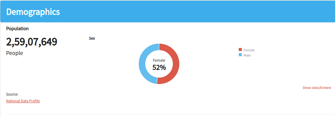 Statistics are broken down into categories. Find a key figure for a sub-category on top.
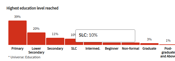 Hover over graphs to see comparisons with the district and country averages.